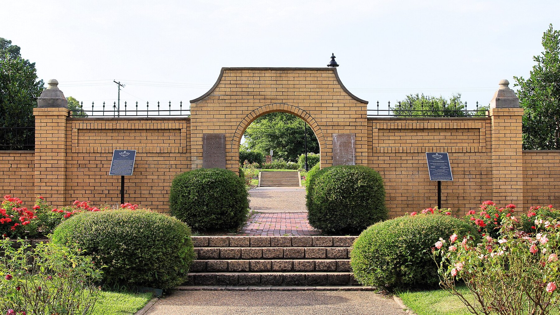
Tyler Rose Garden archway (Taken on 22 June 2019, 18:29:39)

Outdoors

Picnic spots near Tyler

Day-use and picnic areas near Tyler on public land, from quick drives to full-day outings.

23picnic areas
55 mito the closest
February–May, September–Novemberbest months

Good to know: Group picnic sites can often be reserved; fire rules change with the season, so check before bringing a grill.

Closest picks

1

Johnson Creek Day Use

55 mi northeast · US Army Corps of Engineers

Johnson Creek Day Use Area is situated along the banks of the Lake O' the Pines in the Ark-La-Tex portion of the Pineywoods of east Texas near the states of Arkansas, Oklahoma, and Louisiana. Address to get here: 580 Crestwood Lp.

2

Lakeside Day Use

55 mi northeast · US Army Corps of Engineers

Lakeside Day Use Area is situated along the banks of the Lake O' the Pines in the Ark-La-Tex portion of the Pineywoods of east Texas near the states of Arkansas, Oklahoma, and Louisiana.

3

Lake O' The Pines

56 mi northeast · US Army Corps of Engineers

Lake O' the Pines includes about 18,700 acres of water and 9,000 acres of land located in the piney woods of Northeast Texas. The lake is located partially in Marion, Harrison, Upshur, Morris and Camp Counties.

Map of all 23 places

Map of 23 places loads as you scroll.

30 to 75 miles (5)

55 mi northeast · US Army Corps of Engineers · Campground

Johnson Creek Day Use

Johnson Creek Day Use Area is situated along the banks of the Lake O' the Pines in the Ark-La-Tex portion of the Pineywoods of east Texas near the states of Arkansas, Oklahoma, and Louisiana. Address to get here: 580 Crestwood Lp.

  • Boating
  • Camping
  • Fishing
  • Picnicking
  • Swimming
  • Water sports
  • Wildlife viewing

55 mi northeast · US Army Corps of Engineers · Campground

Lakeside Day Use

Lakeside Day Use Area is situated along the banks of the Lake O' the Pines in the Ark-La-Tex portion of the Pineywoods of east Texas near the states of Arkansas, Oklahoma, and Louisiana.

  • Boating
  • Camping
  • Fishing
  • Picnicking
  • Swimming
  • Water sports
  • Wildlife viewing

56 mi northeast · US Army Corps of Engineers

Lake O' The Pines

Lake O' the Pines includes about 18,700 acres of water and 9,000 acres of land located in the piney woods of Northeast Texas. The lake is located partially in Marion, Harrison, Upshur, Morris and Camp Counties.

  • Boating
  • Camping
  • Fishing
  • Hiking
  • Picnicking
  • Water sports
  • Wildlife viewing

72 mi north · US Army Corps of Engineers

Cooper Lake

When complete, will impound the South Sulphur River in Delta and Hopkins Counties.

  • Boating
  • Camping
  • Fishing
  • Hiking
  • Horseback riding
  • Hotel/Lodge/Resort Privately Owned
  • Nature education
  • Picnicking

74 mi southeast · USDA Forest Service

National Forests and Grasslands in Texas

.

  • Biking
  • Boating
  • Camping
  • Fishing
  • Hiking
  • Horse Camping
  • Horseback riding
  • Off-highway vehicles

75 miles and farther (18)

78 mi west · US Army Corps of Engineers

Bardwell Lake

Bardwell Lake is located in the Blackland Prairie region of southwestern Ellis County. Built in 1965 for flood control by the US Army Corps of Engineers, Bardwell Lake is located two miles southwest of Ennis off of State Highway 34.

  • Boating
  • Camping
  • Fishing
  • Hiking
  • Picnicking
  • Water sports
  • Wildlife viewing

80 mi west · US Army Corps of Engineers · Campground

High View

High View Park is on a long peninsula on the western shore of Bardwell Lake, less than an hour south of the Dallas-Fort Worth area in north-central Texas.

  • Boating
  • Camping
  • Picnicking
  • Swimming

85 mi northwest · US Army Corps of Engineers

Lavon Lake

The Heard Natural Science Museum and Wildlife Sanctuary in nearby McKinney features natural history exhibits and nature trails.

  • Boating
  • Camping
  • Fishing
  • Hiking
  • Horseback riding
  • Nature education
  • Picnicking
  • Water sports

85 mi west · US Army Corps of Engineers

Navarro Mills Lake

Navarro Mills Lake holds the state record white crappie at 4lbs 9 ounces.

  • Boating
  • Camping
  • Fishing
  • Hiking
  • Kayaking
  • Picnicking
  • Swimming
  • Water sports

95 mi northeast · US Army Corps of Engineers

Wright Patman Lake

Wright Patman Lake is located in the beautiful piney woods of northeast Texas. The lake includes about 30,000 surface acres of water and 50,000 acres of land.

  • Boating
  • Camping
  • Fishing
  • Hiking
  • Horseback riding
  • Picnicking
  • Water sports
  • Wildlife viewing

99 mi west · US Army Corps of Engineers

Joe Pool Lake

Joe Pool Lake is a 7,400-acre impoundment located in the southern portion of the Dallas-Fort Worth Metroplex.

  • Biking
  • Boating
  • Camping
  • Fishing
  • Hiking
  • History
  • Horseback riding
  • Hotel/Lodge/Resort Privately Owned

107 mi north · US Army Corps of Engineers

Pat Mayse Lake

Pat Mayse Lake is located in the Red River Basin in Lamar County, Texas. The damsite is on Sanders Creek (a tributary of the Red River) approximately one mile south of the town of Chicota, four miles northwest of Powderly and twelve miles…

  • Boating
  • Camping
  • Picnicking
  • Water sports
  • Wildlife viewing

108 mi east · US Army Corps of Engineers

Bayou Bodcau Reservoir

Bayou Bodcau in LA and AR is a flood-control project with no permanent pool. A major waterfowl management and upland game management area is located here.

  • Boating
  • Camping
  • Fishing
  • Hiking
  • Horseback riding
  • Nature education
  • Off-highway vehicles
  • Picnicking

111 mi northwest · US Army Corps of Engineers

Grapevine Lake

Centrally located in the heart of the Dallas/Fort Worth Metroplex just minutes from DFW Airport, Grapevine Lake offers a variety of outdoor recreation opportunities.

  • Biking
  • Boating
  • Camping
  • Fishing
  • Hiking
  • Horseback riding
  • Hotel/Lodge/Resort Privately Owned
  • Nature education

112 mi northwest · US Army Corps of Engineers

Lewisville Lake

Just north of Dallas, popular Lewisville Lake is a 29,592 acre lake with unlimited outdoor recreation opportunities. Over 20 parks surround the lake and offer camping, hiking, picnicking, horseback riding, boating, and golf.

  • Boating
  • Camping
  • Fishing
  • Hiking
  • Horseback riding
  • Hotel/Lodge/Resort Privately Owned
  • Nature education
  • Picnicking

112 mi southeast · US Army Corps of Engineers

Sam Rayburn Reservoir

A 114,000-acre lake in the Big Thicket country of Texas, with native flora including orchids, insect-eating plants and scores of animal species.

  • Boating
  • Camping
  • Fishing
  • Hiking
  • Horseback riding
  • Hotel/Lodge/Resort Privately Owned
  • Picnicking
  • Water sports

114 mi west · US Army Corps of Engineers

Aquilla Lake

This 3,280-acre lake is located on Aquilla and Hackberry Creeks.

  • Boating
  • Fishing
  • Picnicking
  • Water sports
  • Wildlife viewing

117 mi north · US Army Corps of Engineers

Hugo Lake

The Oklahoma Department of Wildlife Conservation manages over 18,000 acres of land and water, which is open to hunting along with an additional 8,000 acres managed by the Corps.

  • Boating
  • Camping
  • Horseback riding
  • Hotel/Lodge/Resort Privately Owned
  • Picnicking
  • Water sports
  • Wildlife viewing

119 mi north · US Army Corps of Engineers

Pine Creek Lake

Pine Creek Dam is located on Little River, approximately eight miles north of Valiant in McCurtain County, Oklahoma. The lake extends into Choctaw and Pushmataha Counties.

  • Boating
  • Camping
  • Hiking
  • Nature education
  • Picnicking
  • Water sports
  • Wildlife viewing

123 mi northeast · US Army Corps of Engineers

Millwood Lake

Millwood is located in the southwest corner of Arkansas on the Little River, 16 miles upstream from its confluence with the Red River. Nine recreation areas offer modern camping facilities.

  • Boating
  • Camping
  • Fishing
  • Hiking
  • Picnicking
  • Water sports
  • Wildlife viewing

123 mi southwest · US Army Corps of Engineers

Waco Lake

The largest lake in the United States to be located entirely within a single city's municiple boundaries.

  • Boating
  • Camping
  • Fishing
  • Hiking
  • Hotel/Lodge/Resort Privately Owned
  • Nature education
  • Picnicking
  • Water sports

124 mi northwest · US Army Corps of Engineers

Ray Roberts Lake

This 29,350-acre rural lake is just a few minutes from the Dallas/Fort Worth Metroplex and is a great place to get away from city life.

  • Boating
  • Camping
  • Fishing
  • Horseback riding
  • Hotel/Lodge/Resort Privately Owned
  • Nature education
  • Picnicking
  • Water sports

125 mi west · US Army Corps of Engineers

Whitney Lake

There are 10 Corps of Engineers parks, one state park, and three additional parks managed by Hill County or private individuals. Equestrian riders have a great place to explore rolling hills and woods in the McCown Valley Equestrian Area.

  • Biking
  • Boating
  • Camping
  • Fishing
  • Hiking
  • Horseback riding
  • Hotel/Lodge/Resort Privately Owned
  • Picnicking

Distances are straight-line miles from downtown Tyler. Listings come from Recreation.gov’s federal recreation database; check each official page for hours, fees, fire restrictions and closures before you go.

Get outside around Tyler

Day Trip to Tyler video thumbnail

THINGS TO DO · YOUTUBE SHORT

Day Trip to Tyler

A full episode of The Daytripper exploring the Rose Capital and its rose garden.

Watch on YouTube ↗

More outdoors near Tyler

Questions

Where is the closest place for picnic spots near Tyler?

Johnson Creek Day Use (US Army Corps of Engineers), about 55 miles northeast of Tyler as the crow flies. Next are Lakeside Day Use (55 mi) and Lake O' The Pines (56 mi).

When is the best time for picnic spots near Tyler?

Based on Tyler’s average highs, February–May, September–November. Conditions at higher elevations can be much cooler.

Who manages these places?

Federal agencies including US Army Corps of Engineers, USDA Forest Service. Each listing links to its official page for hours, fees, closures and current conditions.

Tyler AI

Your Tyler local guide
Hey there!

I'm Tyler AI. Ask about neighborhood food, independent shops, local history or planning a visit.

AI recommendations may be inaccurate. Verify hours and prices. Questions are processed by Cloudflare. Privacy