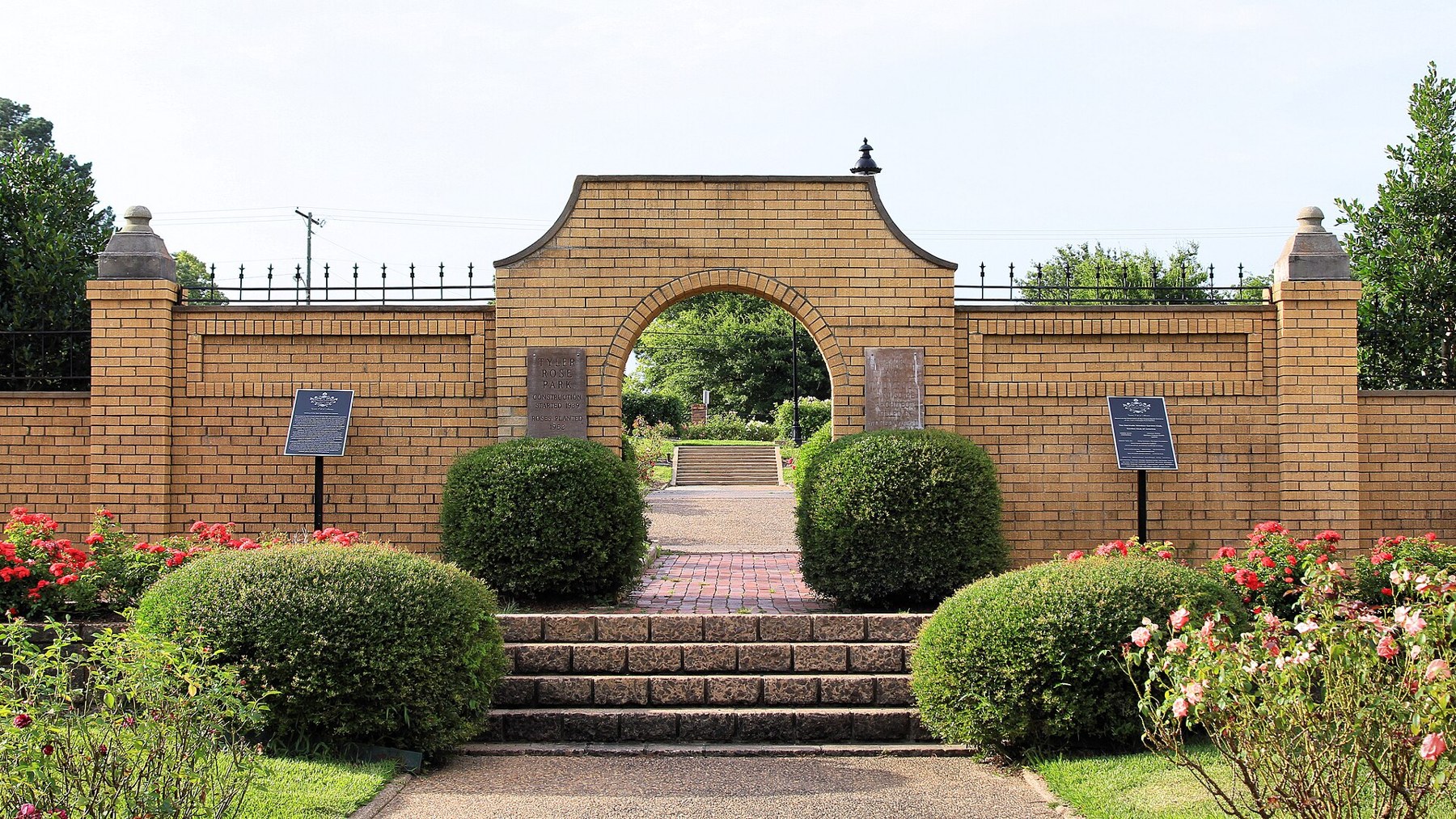
Tyler Rose Garden archway (Taken on 22 June 2019, 18:29:39)

Outdoors

Swimming holes and lakes near Tyler

Lakes, rivers and beaches near Tyler where swimming is allowed on public land.

14places to swim
52 mito the closest
April–Octoberbest months

Good to know: Most natural swimming areas have no lifeguard; check water-quality advisories and current conditions before swimming.

Closest picks

1

Brushy Creek Day Use

52 mi northeast · US Army Corps of Engineers

Brushy Creek Day Use Area is situated along the banks of Lake O' the Pines in the Ark-La-Tex portion of the Pineywoods of east Texas near the states of Arkansas, Oklahoma, and Louisiana. Address to get here: 189 Brushy Creek Park Rd.

2

Alley Creek Camp

53 mi northeast · US Army Corps of Engineers

Alley Creek Campground is situated along the banks of Lake O' the Pines in the Ark-La-Tex portion of the Pineywoods of east Texas near the states of Arkansas, Oklahoma, and Louisiana.

3

Brushy Creek

54 mi northeast · US Army Corps of Engineers

Brushy Creek Campground is situated along the banks of Lake O' the Pines in the Ark-La-Tex portion of the Pineywoods of east Texas near the states of Arkansas, Oklahoma, and Louisiana.

Map of all 14 places

Map of 14 places loads as you scroll.

30 to 75 miles (9)

52 mi northeast · US Army Corps of Engineers · Campground

Brushy Creek Day Use

Brushy Creek Day Use Area is situated along the banks of Lake O' the Pines in the Ark-La-Tex portion of the Pineywoods of east Texas near the states of Arkansas, Oklahoma, and Louisiana. Address to get here: 189 Brushy Creek Park Rd.

  • Boating
  • Camping
  • Fishing
  • Swimming
  • Wildlife viewing

53 mi northeast · US Army Corps of Engineers · Campground

Alley Creek Camp

Alley Creek Campground is situated along the banks of Lake O' the Pines in the Ark-La-Tex portion of the Pineywoods of east Texas near the states of Arkansas, Oklahoma, and Louisiana.

  • Birding
  • Boating
  • Camping
  • Fishing
  • Hiking
  • Hunting
  • Swimming
  • Water sports

54 mi northeast · US Army Corps of Engineers · Campground

Brushy Creek

Brushy Creek Campground is situated along the banks of Lake O' the Pines in the Ark-La-Tex portion of the Pineywoods of east Texas near the states of Arkansas, Oklahoma, and Louisiana.

  • Boating
  • Camping
  • Fishing
  • Hunting
  • Swimming
  • Water sports

55 mi northeast · US Army Corps of Engineers · Campground

Johnson Creek Camp

Johnson Creek Campground is situated along the banks of Lake O' the Pines in the in the Ark-La-Tex portion of the Pineywoods of east Texas near Arkansas, Oklahoma, and Louisiana.

  • Boating
  • Camping
  • Fishing
  • Swimming
  • Water sports
  • Wildlife viewing

55 mi northeast · US Army Corps of Engineers · Campground

Johnson Creek Day Use

Johnson Creek Day Use Area is situated along the banks of the Lake O' the Pines in the Ark-La-Tex portion of the Pineywoods of east Texas near the states of Arkansas, Oklahoma, and Louisiana. Address to get here: 580 Crestwood Lp.

  • Boating
  • Camping
  • Fishing
  • Picnicking
  • Swimming
  • Water sports
  • Wildlife viewing

55 mi northeast · US Army Corps of Engineers · Campground

Lakeside Day Use

Lakeside Day Use Area is situated along the banks of the Lake O' the Pines in the Ark-La-Tex portion of the Pineywoods of east Texas near the states of Arkansas, Oklahoma, and Louisiana.

  • Boating
  • Camping
  • Fishing
  • Picnicking
  • Swimming
  • Water sports
  • Wildlife viewing

56 mi northeast · US Army Corps of Engineers · Campground

Buckhorn Creek

Buckhorn Creek Campground is situated along the banks of Lake O' the Pines in the Ark-La-Tex portion of the Pineywoods of east Texas near the states of Arkansas, Oklahoma, and Louisiana.

  • Boating
  • Camping
  • Fishing
  • Hiking
  • Swimming
  • Water sports
  • Wildlife viewing

65 mi south · USDA Forest Service · Campground

Ratcliff Lake Recreation Area

Ratcliff Lake Recreation Area was built in 1936 by the Civilian Conservation Corps.

  • Boating
  • Camping
  • Canoeing
  • Fishing
  • Hiking
  • History
  • Kayaking
  • Swimming

74 mi southeast · USDA Forest Service

National Forests and Grasslands in Texas

.

  • Biking
  • Boating
  • Camping
  • Fishing
  • Hiking
  • Horse Camping
  • Horseback riding
  • Off-highway vehicles

75 miles and farther (5)

80 mi west · US Army Corps of Engineers · Campground

High View

High View Park is on a long peninsula on the western shore of Bardwell Lake, less than an hour south of the Dallas-Fort Worth area in north-central Texas.

  • Boating
  • Camping
  • Picnicking
  • Swimming

80 mi west · US Army Corps of Engineers · Campground

Mott

Mott Park is located on the western shore of Bardwell Lake, less than an hour south of the Dallas-Fort Worth area in north-central Texas.

  • Boating
  • Camping
  • Fishing
  • Swimming

83 mi northwest · US Army Corps of Engineers · Campground

Lavonia

Lavonia Campground is a scenic Texas getaway just beyond the Dallas metropolitan area. Visitors can camp, swim, fish, boat or use the day use area.

  • Boating
  • Camping
  • Fishing
  • Swimming

85 mi west · US Army Corps of Engineers

Navarro Mills Lake

Navarro Mills Lake holds the state record white crappie at 4lbs 9 ounces.

  • Boating
  • Camping
  • Fishing
  • Hiking
  • Kayaking
  • Picnicking
  • Swimming
  • Water sports

85 mi west · US Army Corps of Engineers · Campground

OAK (Navarro Mills Lake)

Oak Park is located on the northeastern shore of Navarro Mills Lake in central Texas. Visitors can enjoy a view of the lake from the facility and participate in popular outdoor actives like camping, boating, fishing and picnicking.

  • Boating
  • Camping
  • Fishing
  • Swimming

Distances are straight-line miles from downtown Tyler. Listings come from Recreation.gov’s federal recreation database; check each official page for hours, fees, fire restrictions and closures before you go.

Get outside around Tyler

Day Trip to Tyler video thumbnail

THINGS TO DO · YOUTUBE SHORT

Day Trip to Tyler

A full episode of The Daytripper exploring the Rose Capital and its rose garden.

Watch on YouTube ↗

More outdoors near Tyler

Questions

Where is the closest place for swimming near Tyler?

Brushy Creek Day Use (US Army Corps of Engineers), about 52 miles northeast of Tyler as the crow flies. Next are Alley Creek Camp (53 mi) and Brushy Creek (54 mi).

When is the best time for swimming near Tyler?

Based on Tyler’s average highs, April–October. Conditions at higher elevations can be much cooler.

Who manages these places?

Federal agencies including US Army Corps of Engineers, USDA Forest Service. Each listing links to its official page for hours, fees, closures and current conditions.

Tyler AI

Your Tyler local guide
Hey there!

I'm Tyler AI. Ask about neighborhood food, independent shops, local history or planning a visit.

AI recommendations may be inaccurate. Verify hours and prices. Questions are processed by Cloudflare. Privacy